|
 Weather Condition Weather Condition |
| From March to May, migratory high pressure passes through Kanto Plain at intervals. By the delicate difference in the form of the high pressure, or the position which it passes, condition can roughly be divided into 4 patterns. |
|
 |
|
| ● |
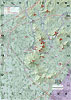
Maps which were used for Japan Paraglider Association national league Coo Spring Cup 2006 which was held 2006 spring. |
|
|
|
|
|
|
|
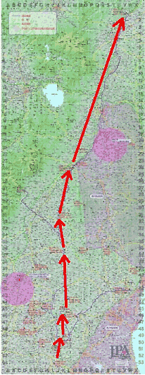
A. Favorable terms, south wind condition
In this season, south wind blew around the Mt. TSUKUBA which is famous for XC Mecca in Japan, XC big task which goes north along the Mt. YAMIZO will be suggested. Depending on the condition, the goal would be changed by how far a south wind goes north. From south, KARASUYAMA (40km), KUROBANE (70km), SHIRAKAWA (95km), and the southernmost, KOMIYAMA (125km) is expected.
It becomes the straight goal after coming by some turning points around the Mt. TSUKUBA range in the first half. However, even if it is called a straight, there are some course selections, and to assess how the convergence line forms will become the key which decides the outcome.
|
|
 |
|
|
|
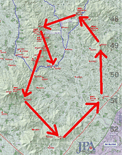
B. Favorable terms, but north wind base condition
If it becomes like this, Mt. TSUKUBA‘s specialty "circuit of YASATO" task can be considered. You will have to turn around extrados mountain which surround the YASATO basin and becomes about 40km of round, it is necessary to assess a local wind and make it become an ally.
Even main stream are north winds in this season, in the south of the YASATO basin, a south wind blew in the afternoon in many cases. If it becomes like this, the convergence line of a north wind and a south wind will be formed in a basin. The plain from the Mt. RYUJIN to MAIKE which is located east side of the basin is the place where the only mountain has run out. |
|
 |
|
A convergence line can become the key point to clear this hardest point without stacking.
Expected turning points would be Mt. Tsukuba, Asahi path, Mt. AGAKUNI, Mt. TSUBAME which make a circuit of YASATO. This task would be enjoyable because galleries could see the pilots who fly around the big YASATO basin circuit, so they are able to follow the race. |
|
|
|
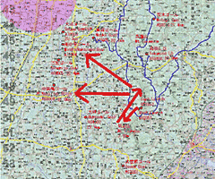
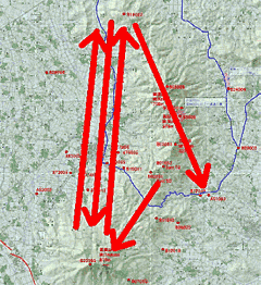
C. +a flatland of west side of Tsukuba
Out - and - return task which is some round trips between Mt. TSUKUBA and antenna of Mt. AMABIKI which lies north and south. This task would be suggested only under weak thermal condition. Under good condition, task A and B have a priority.
|
|
 |
|
|
|
D. Weak wind, weak thermal condition
Recently, hang glider successfully makes triangle flights which connects SHIMOTSUMA city and OYAMA city located in west side of Mt. TSUKUBA. This airspace has a big possibility.
Although it’s not necessarily to say that this task is only for weak thermal condition, but when the convergence line of north and south is formed in western flat land, this task would be the most challenging task. Although possibility is low, if this task is used, it would be the dream task which is a big leap to the paragliding competition held in this TSUKUBA area. |
|
 |
|
|
|
|
△Page Top |
|
|